Dubai Metro Map With Tourist Attractions: A Practical Guide
Use Dubai Metro and Tram stations to reach major attractions, heritage districts, malls, Marina, JBR and neighbourhoods with fewer unnecessary transfers.
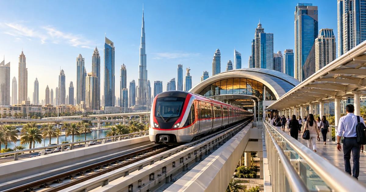
Dubai Metro is most useful when it forms the spine of an itinerary. Many attractions require a walk, Tram connection, bus or short taxi ride after the train, so the nearest station is not always the fastest final route.
Station names, service hours, fares and connections can change. Use the current RTA map and journey planner before travelling instead of saving an old third-party image.
Red Line attraction clusters
The Red Line connects the airport corridor, central Sheikh Zayed Road, Downtown, Mall of the Emirates, Marina, JLT and the Expo branch.
- Burj Khalifa/Dubai Mall station: Downtown and Dubai Mall through the pedestrian link.
- Emirates Towers and Financial Centre: Museum of the Future exterior, DIFC and architecture routes.
- Business Bay station: onward connections to Business Bay and Dubai Water Canal.
- Mall of the Emirates station: direct mall access and Ski Dubai.
- Sobha Realty and DMCC: Dubai Marina, Marina Mall connections and Tram access.
- Ibn Battuta station: Ibn Battuta Mall and onward transport.
- Expo 2020 station: Expo City Dubai and current district events.
Green Line heritage clusters
The Green Line is useful for Creek-side districts, souks and older Dubai. Walking conditions and exact entrances should be checked.
- Al Ghubaiba: heritage and waterfront connections.
- Sharaf DG: Bur Dubai and Al Fahidi approaches.
- Al Ras: Deira Creek-side commercial areas.
- Gold Souq: Gold Souk and nearby districts.
- Creek: Al Jaddaf waterfront connections.
- BurJuman and Union: Red and Green Line interchanges.
Tram connections for Marina and JBR
The Tram connects Marina Metro stations with JBR, Marina and the Palm Monorail connection area. Route direction matters, so check the map before boarding.
For the beach, allow for the walk from the stop and carry what you need rather than returning repeatedly to the station.
Tickets, zones and practical use
RTA calculates fares by zones and card or ticket type. Tap in and out correctly, maintain the required balance and follow cabin rules. Use the official fare page for current prices.
During busy periods, leave additional platform and transfer time. Travellers with large luggage should avoid peak commuter services where possible.
Before you proceed
- ✓Open the current RTA rail map.
- ✓Check station name and exit.
- ✓Plan the final walk or connection.
- ✓Confirm service hours for the return.
- ✓Keep sufficient nol balance.
- ✓Allow extra time during peak periods.
Dubai Metro Map With Tourist Attractions: A Practical Guide FAQs
Which Dubai attractions are close to Metro stations?+
Dubai Mall, parts of Downtown, Museum of the Future and DIFC, Mall of the Emirates, Marina, JLT, Ibn Battuta Mall, Expo City and Creek-side districts have useful rail connections.
Can I reach JBR by Dubai Metro?+
Use a Marina-area Red Line station and connect to the Dubai Tram or continue by walking or taxi, depending on the exact destination.
Which Metro line is best for old Dubai?+
The Green Line serves several stations around Bur Dubai, Deira, the Creek and souk districts, with interchanges at BurJuman and Union.
Where should I download the Dubai Metro map?+
Use the Roads and Transport Authority station-map page or official RTA journey-planning tools so station names remain current.
Official resources and further reading
Rules, services and fees can change. Check the latest position with the relevant authority before acting.
This guide is general information, not legal, financial or investment advice. Property availability, prices, processes and official requirements can change.
 Dubai Living
 Dubai Living
 Dubai Living